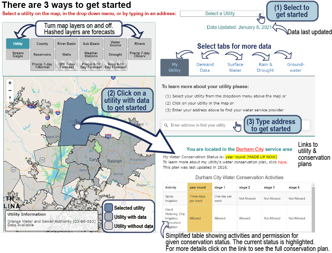
To learn more about your utility please:
- (1) Select your utility from the dropdown menu above the map or
- (2) Click on your utility in the map or
- (3) Enter your address above to find your water service provider
Select a utility
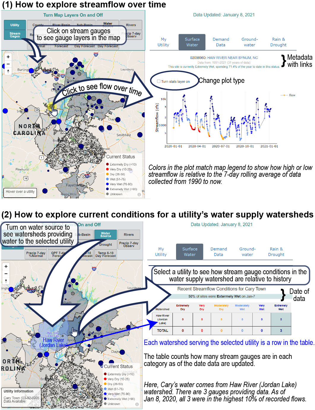
Select a stream gauge or reservoir to see plot
Recent Streamflow Conditions for Selected Utility Watersheds
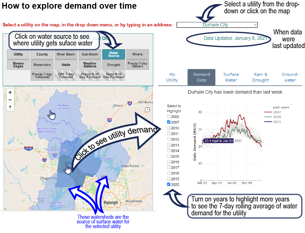
Select a utility to see water demand
Select to Highlight
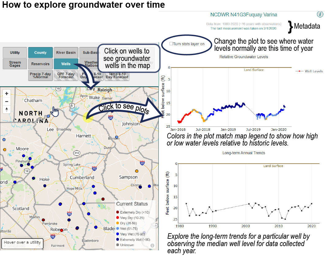
Select a well from the map for more information
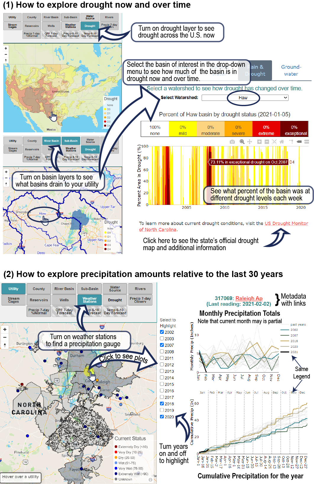
Select a watershed to see how drought changes over time
To learn more about current drought conditions, visit the US Drought Monitor of North Carolina.
Select a precipitation gauge from the map for more information
Select to Highlight

